AKA: none
Other ID: F-01-13-MC
Status: Completed
Organization(s): National Oceanic and Atmospheric Administration, Royal Netherlands Institute for Sea Research, Bureau of Ocean Energy Management, Florida State University, University of North Carolina, Wilmington, USGS, Pacific Coastal and Marine Science Center
Funding Program(s): Atlantic Canyons (BA09FFV)
Principal Investigator(s): Nancy Prouty
Affiliate Investigator(s):
Information Specialist(s): Olivia Cheriton, Nancy Prouty
Data Type(s): Sampling: Geology, Time Series: Mooring (physical oceanography)
Scientific Purpose/Goals: mooring recovery of deep sea mooring sediment trap
Vehicle(s):
Start Port/Location: Charleston, SC
End Port/Location: Charleston, SC
Start Date: 2013-08-21
End Date: 2013-08-28
Equipment Used: tripod, samples
Information to be Derived: sediment transport in deep sea coral communities of the Mid-Atlantic region
Summary of Activity and Data Gathered:
Staff: Olivia Cheriton
Affiliate Staff:
Notes: Mooring recovery of deep sea mooring sediment trap
Staff information imported from InfoBank
Olivia Cheriton
Jonathan Borden
Location:
Mid Atlantic Canyons (Norfolk and Baltimore Canyons)
| Boundaries | |||
|---|---|---|---|
| North: 41.75 | South: 34.25 | West: -77.25 | East: -65.25 |
Platform(s):
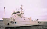 Nancy Foster |
Prouty, N.G., Mienis, F., Campbell, P.L., and Roark, E.B., 2017, Sediment trap and water column chemistry, Baltimore Canyon, U.S. Mid-Atlantic Bight: U.S. Geological Survey data release.
| Survey Equipment | Survey Info | Data Type(s) | Data Collected |
|---|---|---|---|
| tripod | --- | Mooring (physical oceanography) | |
| samples | --- | Biology Chemistry Geology |
