| Description |
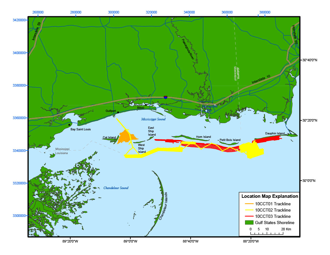
In March and April of 2010 the U.S. Geological Survey (USGS), in cooperation with the U.S. Army Corps of Engineers (USACE), conducted geophysical surveys to investigate the geologic controls on island framework from just east of Cat Island, Mississippi, to Dauphin Island, Alabama, as part of a broader USGS study on Coastal Change and Transport (CCT). This report serves as an archive of unprocessed digital Chirp seismic reflection data, trackline maps, navigation files, Geographic Information System (GIS) files, Field Activity Collection System (FACS) logs, and formal Federal Geographic Data Committee (FGDC) metadata. Gained (showing a relative increase in signal amplitude) digital images of the subbottom profiles are also provided. For more information on the seismic surveys see http://walrus.wr.usgs.gov/infobank/c/c110gm/html/c-1-10-gm.meta.html, http://walrus.wr.usgs.gov/infobank/m/m210gm/html/m-2-10-gm.meta.html, and http://walrus.wr.usgs.gov/infobank/i/i310gm/html/i-3-10-gm.meta.html These data are also available via GeoMapApp (http://www.geomapapp.org/) and Virtual Ocean ( http://www.virtualocean.org/) earth science exploration and visualization applications. [More]
|
