| Description |
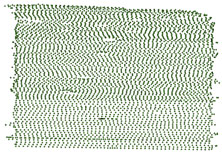
The USGS Woods Hole Science Center conducted a nearshore geophysical survey offshore of the southern coast of Martha's Vineyard, in the vicinity of the Martha's Vineyard Coastal Observatory (MVCO) in August 2007. This mapping program was part of a larger research effort supporting the Office of Naval Research (ONR) Ripples Directed-Research Initiative (DRI) studies at MVCO by providing data collection and modeling. The geophysical data will be used to provide initial conditions for wave and circulation models for the study area. Ultimately, geophysical mapping, oceanographic measurements and modeling will help to improve our understanding of coastal sediment-transport processes. The geophysical mapping utilized a suite of high-resolution instrumentation to map the surficial sediment distribution, depth and sub-surface geology: dual-frequency 100/500 KHz sidescan-sonar system, 234-KHz interferometric sonar, and 500 Hz -12 KHz chirp sub-bottom profiler. The survey was conducted aboard the M/V Megan Miller August 9-13, 2007. The study area covers 35 square kilometers from about 0.2 km to 5-km offshore of the south shore of Martha's Vineyard, and ranges in depth from ~ 5 to 20 meters. [More]
|
