| Online link | https://cmgds.marine.usgs.gov/catalog/whcmsc/open_file_report/ofr2010-1332/hw1_q04.tif.faq.html |
|---|---|
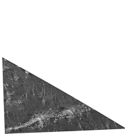
| Description | Survey of the southeastern Hawaiian Ridge was the fifth major segment of the Exclusive Economic Zone (EEZ) mapping program to have been initiated. Data acquisition for this region required approximately one-half year and were acquired during eight cruises over a four year period from 1986 through 1989, skipping 1987. At the conclusion of the survey 29 mosaics of a 2 degree by 2 degree were completed for the region. As in earlier EEZ reconnaissance surveys, the USGS utilized the GLORIA (Geological LOng-Range Inclined Asdic) sidescan-sonar system to complete the geologic mapping. The collected GLORIA data were processed and digitally mosaicked to produce continuous imagery of the seafloor. A total of twenty-seven digital mosaics of a 2 degree by 2 degree area and 2 mosaics of 2.25 degree by 2 degree with a 50-meter pixel resolution were completed for the region. [More] |
| Originators | U.S. Geological Survey; Paskevich, Valerie F.; Wong, Florence L.; O'Malley, John J.; Stevenson, Andrew J.; and Gutmacher, Christina E. |
