| Online link | https://cmgds.marine.usgs.gov/catalog/whcmsc/open_file_report/ofr2003-001/folger75.shp.faq.html |
|---|---|
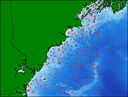
| Description | The reconnaissance maps upon which this data set is based show the areal distribution of the major bottom sediment types covering the sea floor off eastern New England between Cape Ann and Casco Bay. The maps were intended as a guide to the future mapping of gravel, sand, silt, and clay, and because these sediments reflect the hydraulic conditions, they are also helpful for deducing the important sediment transport mechanisms. |
| Originators | Poppe, Lawrence J.; Paskevich, Valerie F.; Williams, S. Jeffress; Hastings, Mary E.; Kelley, John T.; Belknap, D. F.; Ward, Larry G.; Fitzgerald, D. M.; and Larsen, Peter F. |
