| Description |
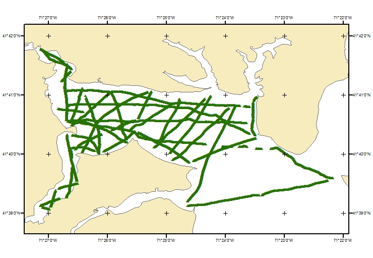
As part of a larger investigation to understand groundwater-surface water interactions in Greenwich Bay, Rhode Island, a geophysical survey was conducted from a small research boat on 14-15 May 2009. The specific research objective was to gain an improved understanding of the role of direct groundwater discharge in delivery of excess nitrogen to the bay, which may have contributed to the development of low-oxygen conditions in waters of the bay and associated fish kills. Data collected in this survey included digital navigation information, continuous resistivity profiling (CRP) data, and point salinity measurements. The CRP method is a survey and data processing approach that is sensitive to differences in electrical properties of surface water and underlying porewater in sediments that have contrasting salinities. During the survey, Greenwich Bay salinity was approximately 27 ppm, so surface water would be expected to have low electrical resistivity (high conductivity), and any areas of active groundwater discharge from less salty aquifer sources would yield relatively higher resistivity values. This survey is identified as field activity 09021 (also referenced as 2009-021-FA) by the U.S. Geological Survey, Woods Hole, Massachusetts, and additional information is available from: https://cmgds.marine.usgs.gov/fan_info.php?fan=2009-021-FA. [More]
|
