AKA: F0207NC
Other ID: F-2-07-NC
Status: Completed
Organization(s): USGS, Pacific Coastal and Marine Science Center
Funding Program(s): Coastal Change Hazards (MU051), North Central Coast Mapping Project (MU208)
Principal Investigator(s): John Chin, Stephanie Ross
Affiliate Investigator(s):
Information Specialist(s): Stephanie Ross
Data Type(s): Location-Elevation: Navigation, Seismics: Sparker, Seismics: Sub Bottom Profiler
Scientific Purpose/Goals: Subbottom mapping of state waters from Ano Nuevo to San Francisco to determine evidence for previously mapped offshore faults and recency of faulting and to determine thickness of Holocene sediments. To verify surficial mapping based on multibeam with surficial features and sediment cover based on subbottom systems.
Vehicle(s):
Start Port/Location: Half Moon Bay, CA
End Port/Location: Half Moon Bay, CA
Start Date: 2007-03-22
End Date: 2007-04-06
Equipment Used: GPS, 512 chirp, sparker
Information to be Derived: Isopach map of Holocene sediment thickness; Map of offshore faults and evidence for faulting and recency of fault activity
Summary of Activity and Data Gathered:
Staff: Ginger Barth, Michael Boyle, Brian Edwards, Patrick Hart, Gerry Hatcher, Larry Kooker, Dennis Mann, Diane Minasian, Ray Sliter, Peter Triezenberg, Jonathan Childs
Affiliate Staff:
Ann Gartner - Mammal Observer
Dave Minard (NOAA
) - Captain
Chris Wilcox (NOAA
) - Mate
Notes: Staff information imported from InfoBank
John Chin - Chief Scientist
Stephanie Ross - Chief Scientist
Ray Sliter - Data Acquisition
Pat Hart - Data Acquisition
Dennis Mann (Mammal Observer) - Data Acquisition
Jon Childs - Data Acquisition
Ginger Barth - Mammal Observer
Peter Triezenberg - Mammal Observer
Ann Gartner - Mammal Observer
Diane Minasian - Mammal Observer
Mike Boyle - Electronic Technician
Larry Kooker - Electronic Technician
Gerry Hatcher - Electronic Technician
Brian Edwards - Guest Scientist
Dave Minard (NOAA, ) - Captain
Chris Wilcox (NOAA, ) - Mate
Location:
Ano Nuevo to San Francisco
| Boundaries | |||
|---|---|---|---|
| North: 37.7595 | South: 37.28382 | West: -122.799 | East: -122.4103 |
Platform(s):
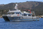 Fulmar |
Edwards, B.D., Phillips, E.L., Dartnell, P., Greene, H.G., Bretz, C.K., Kvitek, R.G., Hartwell, S.R., Johnson, S.Y., Cochrane, G.R., Dieter, B.E., Sliter, R.W., Ross, S.L., Golden, N.E., Watt, J.T., Chin, J.L., Erdey, M.D., Krigsman, L.M., Manson, M.W., and Endris, C.A., 2015, California State Waters Map SeriesâOffshore of Pacifica, California: In: Cochran, S.A., and Edwards, B.D. (Eds.). U.S. Geological Survey Open-File Report 2014-1260, 38 p.
Ross, S.L., Chin, J.L., Johnson, S.Y., and Sliter, R.W., 2019, Chirp and minisparker seismic-reflection data of field activity F-02-07-NC collected offshore San Mateo County, California, from 2007-03-22 to 2007-04-06: U.S. Geological Survey data release, https://doi.org/10.5066/P980S50B.
FAN F207NC has data viewable in the GeoMappApp/Virtual Ocean applications. To view this data in these applications go to http://www.geomapapp.org/ and http://www.virtualocean.org/. See the instructions for locating USGS data in these applications. You can also view the imagery created from the SEGY data at https://cmgds.marine.usgs.gov/images.php?cruise=F207NC.
| Survey Equipment | Survey Info | Data Type(s) | Data Collected |
|---|---|---|---|
| GPS | --- | Navigation | Best file with nav in ArcInfo E00 format Global positioning system (GPS) data f-2-07-nc.060 Global positioning system (GPS) data f-2-07-nc.061 (Provisional best file) Global positioning system (GPS) data f-2-07-nc.061_eotcssp Scan f-2-07-nc.seis.pdf |
| 512 chirp | --- | Sub Bottom Profiler | Chirp seismic data Chirp seismic-reflection data collected offshore San Mateo County, California (High-resolution single-channel Chirp seismic-reflection data were collected by the U.S. Geological Survey in March and April 2007 from Pacifica to Half Moon Bay, offshore San Mateo County, California. Data were collected aboard the R/V Fulmar, during field activity F-02-07-NC. Chirp data were collected using an EdgeTech 512 chirp subbottom system and recorded with a Triton SB-Logger.) |
| sparker | --- | Sparker | Sparker seismic data Minisparker seismic-reflection data collected offshore San Mateo County, California (High-resolution single-channel minisparker seismic-reflection data were collected by the U.S. Geological Survey in March and April 2007 from San Francisco to San Gregorio, offshore San Mateo County, California. Data were collected aboard the R/V Fulmar, during field activity F-02-07-NC. Minisparker data were collected using a SIG 2-mille minisparker sound source combined with a single-channel streamer, and recorded with a Triton SB-Logger.) |
