Imagery Data System

The image displayed on this page is a thumbnail, please use the download function to obtain the full-resolution image.
Filename: 2023022FA_PXL_20230913T203544Z.jpg
This image is part of the data release:
Topographic data, imagery, and ground control data collected in September 2023 pre and post Hurricane Lee at Head of the Meadow, Marconi, and Nauset Light beaches, Cape Cod National Seashore, Massachusetts
Image data:
- Keywords:
- Cape cod national seashore
- Collection:
2023_NLB_context
- Field activity number:
2023-022-FA:
More images from FAN |
CMGDS details
- Topic: Geology, Mapping, Remote Sensing, and Geospatial Data
- Purpose: Field activity
- Class: Structure-from-Motion, Operations
- Subject: beach
- Semantic Location: Nauset, Cape Cod, Massachusetts
- People:
No people visible in image
- FAN: Woods Hole Coastal and Marine Science Center
- Public: True
- File Size: 1381741 bytes
- Uploaded By: sackerman
- Uploaded At: Nov. 21, 2023, 4:48 p.m. (UTC)
Imagery header data:
- Credit: U.S. Geological Survey
- Contact: WHSC_data_contact@usgs.gov
- Copyright: Public Domain
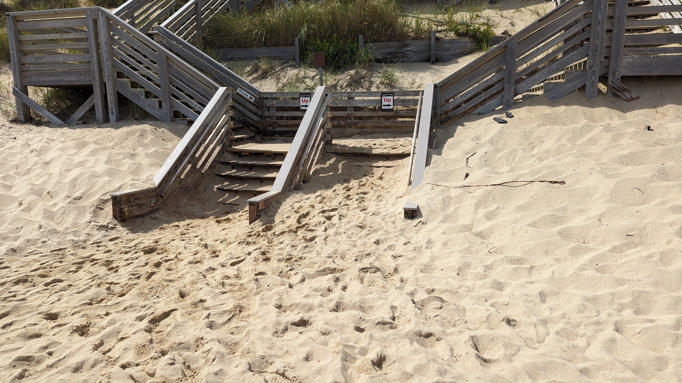
- Image Description: https://cmgds.marine.usgs.gov/fan_info.php?fan=2023-022-FA; The bottom of the stairs at Marconi Beach before Hurricane Lee.
- Attribution URL: https://doi.org/10.5066/P9GA5RJD
- GPS Latitude: 41.891036
- GPS Latitude Reference: N
- GPS Longitude: -69.962418
- GPS Longitude Reference: W
- GPS Time Stamp (UTC): 17:35:44
- Date/Time Original: 2023-09-13 12:35:44
- Date/Time Modified: 2023-09-13 12:35:44
- PID (Image Unique ID): 3ea2f8035e941d090000000000000000
- Artist: Christopher Sherwood
- Preserved Filename: PXL_20230913_163544889.jpg
- External Metadata Link: https://www1.usgs/gov/pir/api/identifiers/USGS:6511a3bdd34e823a0275dbdf
- Camera Make: Google
- Camera Model: Pixel 6