The image displayed on this page is a thumbnail, please use the download function to obtain the full-resolution image.
Filename: 2024020FA_ClearviewVegSurvey_RefID_4_context.jpeg
This image is part of the data release:
Topographic data, aerial imagery, and GPS data collected during uncrewed aircraft system (UAS) operations at Lower Darby Creek, Darby Township, Pennsylvania, March to August 2024
Image data:
- Keywords:
- Collection:
2024Aug_Darby_veg
- Field activity number:
2024-020-FA:
More images from FAN |
CMGDS details
- Topic: Geology, Mapping, Remote Sensing, and Geospatial Data
- Purpose: Field activity
- Class: Structure-from-Motion, Core or Sample
- Subject: vegetation
- Semantic Location: Darby Township, PA
- Science Center: Woods Hole Coastal and Marine Science Center
- File Size: 6057278 bytes
Imagery header data:
- Credit: U.S. Geological Survey
- Contact: WHSC_data_contact@usgs.gov
- Copyright: Public Domain
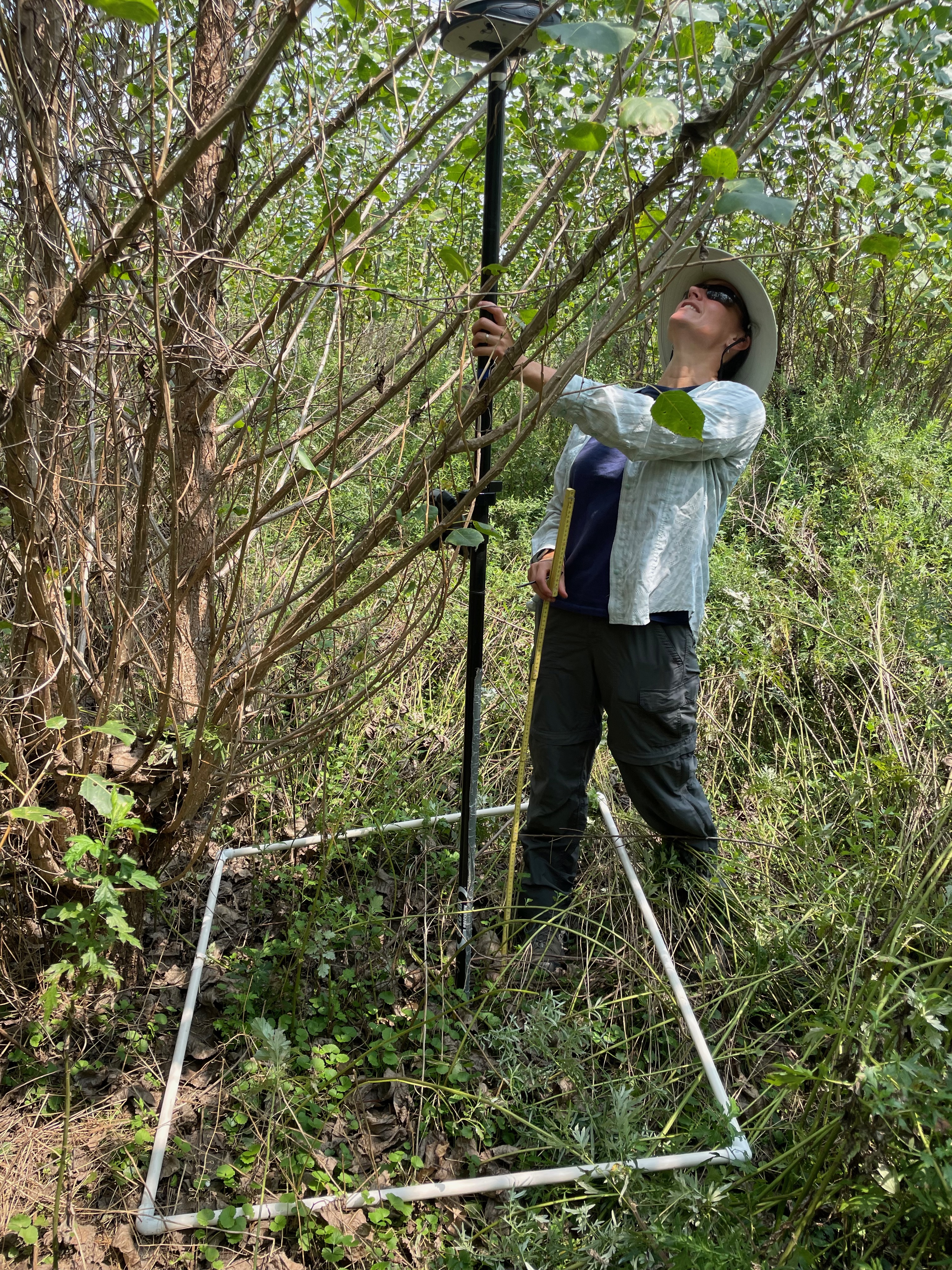
- Image Description: https://cmgds.marine.usgs.gov/fan_info.php?fan=2024-020-FA; Vegetation sample photograph at the Clearview Landfill, Lower Darby Creek Superfund, Darby Township, Pennsylvania, taken with a commercial smartphone camera during USGS field activity 2024-020-FA
- Attribution URL: https://doi.org/10.5066/P134HU3Y
- GPS Latitude: 39.9002638888889
- GPS Latitude Reference: N
- GPS Longitude: -75.2546166666667
- GPS Longitude Reference: W
- GPS Area Information: camera-integrated GPS
- GPS Map Datum: EPSG::4326 (WGS84)
- Date/Time Original: 2024-08-14 12:44:34
- Date/Time Modified: 2024-08-14 12:44:34
- Artist: WHCMSC AIM Group
- Preserved Filename: 2024020FA_ClearviewVegSurvey_RefID_4_context.jpeg
- External Metadata Link: https://www1.usgs.gov/pir/api/identifiers/USGS:67644a60d34e5335adadf390
- Camera Make: Apple
- Camera Model: iPhone 12 Pro