Field Activity 05SCC01

Identifier 05SCC01
Alternate names G-1-05-LA
Purpose Seafloor mapping
Location Offshore of Port Fourchon and Timbalier Bay, Louisiana, Louisiana
Summary 
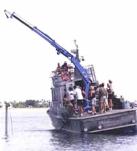
Chirp (23 lines), vibracores 05LCA01 through 10
Info derived Geophysical Data
Comments Digital 05SCC01 FACS logs were generated by A. Harrison in June of 2006 using the handwritten logs and personal accounts of the crew members. This field activity was edited to add vibracores based on core description logs found during records management efforts, these cores have been added to the SPCMSC samples database and associated with this field activity.
Projects
Platform
G.K. Gilbert
40'
Itinerary
Start Port Fourchon, LA 2005-08-08
End Port Fourchon, LA 2005-08-15
Bounds
West -90.4178
East -89.95557
North 29.11443
South 29.02221

Personnel

Organization
600 Fourth Street South
St. Petersburg, FL33701-4846
(727) 502-8000
Principal investigators James G Flocks
Crew members

Data types and categories

Data category: Sampling, Location-Elevation, Seismics
Data type: Geology, Navigation, Sub Bottom Profiler

Equipment used

Equipment Usage description Data types Datasets
Vibracorer Geology (no data reported)
GPS Navigation 2
Chirp 424 Sub Bottom Profiler 1

Datasets

Datasets produced in this activity

Dataset name Equipment Description Dataset contact
Processed 1000-Shot-Interval Location Navigation GPS James G Flocks
Processed Shotpoint Navigation GPS James G Flocks
Chirp seismic data Chirp 424 James G Flocks

Publications

Samples collected during this field activity