| Identifier | 10BIM04 | ||||||||
|---|---|---|---|---|---|---|---|---|---|
| Purpose | Geomorphology, Geology, Island Evolution | ||||||||
| Location | MS Barrier Islands | ||||||||
| Summary | A total of 119 chirp 2-D subbottom profiles, 79 swath, 9 single beam, and 9 sidescan lines were collected. | ||||||||
| Info derived | Geologic framework to determine the island geomorphology, stratigraphy and geologic history. | ||||||||
| Comments | Additional Equipment: Knudsen 320. | ||||||||
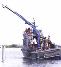
| Platform |
|
||||||||
| Itinerary |
|
||||||||
| Bounds |
|
||||||||
| Topic | 6 | ||||||||
| Marine operations | Yes |
| Organization |
600 Fourth Street South
St. Petersburg, FL33701-4846
(727) 502-8000
|
||||||
|---|---|---|---|---|---|---|---|
| Principal investigators | Jack L KindingerJennifer L Miselis | ||||||
| Crew members |
|
||||||
| Information specialist(s) |
|
||||||
| Affiliate principal | Dawn Lavoie |
| Data category: | Location-Elevation, Seismics, Sonar |
|---|---|
| Data type: | Benchmarks, Navigation, Profiles, Transects, Sub Bottom Profiler, Interferometric, Multibeam, Sidescan, Single Beam, Sound Velocity |
| Equipment | Usage description | Data types | Datasets |
|---|---|---|---|
| Interferometric Bathymetry System | Interferometric | 2 | |
| F190 DGPS/IMU | Navigation | (no data expected) | |
| Choke Ring Antenna | Benchmarks, Navigation | (no data expected) | |
| Ashtech Z-Xtreme DGPS | Benchmarks, Navigation | 1 | |
| Chirp 512i | Sub Bottom Profiler | 5 | |
| Knudsen 320 Echosounder | Single Beam | (no data reported) | |
| Valeport Mini Sound Velocity Probe | Sound Velocity | (no data reported) | |
| Klein Side Scan Sonar | Sidescan | 1 |
| Dataset name | Equipment | Description | Dataset contact |
|---|---|---|---|
| 10BIM04-BA-pd-1 | Interferometric Bathymetry System | Swath Interferometric bathy grid as Geotiff | Noreen A Buster |
| 10BIM04-BA-pd-2 | Interferometric Bathymetry System | Data Series 739 GIS dataset | Noreen A Buster |
| 10BIM04-BA-pd-5 | Ashtech Z-Xtreme DGPS | Swath bathymetry trackline shapefile | Arnell S Forde |
| 10BIM04-SE-pd-4 | Chirp 512i | Chirp 512i data GeoMapApp | Arnell S Forde |
| DS 724 arc | Chirp 512i | Chirp 512i data GIS | Arnell S Forde |
| DS 724 nav | Chirp 512i | Chirp 512i data navigation | Arnell S Forde |
| DS 724 profiles | Chirp 512i | Chirp 512i data profiles | Arnell S Forde |
| DS 724 segy | Chirp 512i | Chirp 512i data agc SEGY | Arnell S Forde |
| 10BIM04-BS-pd-1 | Klein Side Scan Sonar | Side Scan Sonar grid as GeoTiff | Arnell S Forde |