| Identifier | 13LTS05 | ||||||||
|---|---|---|---|---|---|---|---|---|---|
| Purpose | to collect lidar data | ||||||||
| Location | Suncook NH | ||||||||
| Summary | Elevation data was collected | ||||||||
| Info derived | Elevation data | ||||||||
| Projects | |||||||||
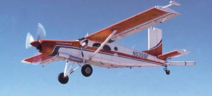
| Platform |
|
||||||||
| Itinerary |
|
||||||||
| Bounds |
|
| Organization |
600 Fourth Street South
St. Petersburg, FL33701-4846
(727) 502-8000
|
||
|---|---|---|---|
| Principal investigators | Brock, John | ||
| Crew members | |||
| Information specialist(s) |
|
| Data category: | Location-Elevation |
|---|---|
| Data type: | LIDAR |
| Equipment | Usage description | Data types | Datasets |
|---|---|---|---|
| Red Green Blue (RGB) Digital Camera | Other Imagery | (no data reported) | |
| Infrared Digital Camera | Other Imagery | (no data reported) | |
| Global Positioning System (GPS) | Navigation | (no data reported) | |
| Experimental Advanced Airborne Research Lidar (EAARL) | LIDAR | 3 |
| Dataset name | Equipment | Description | Dataset contact |
|---|---|---|---|
| SNCK2013_EAARLB_SM_z19_n88g12A.zip | Experimental Advanced Airborne Research Lidar (EAARL) | EAARL-B seamless (bare earth and submerged) topography extent for the Suncook River in New Hampshire. | Alexandra M Fredericks |
| Dataset name | Equipment | Description | Dataset contact |
|---|---|---|---|
| Lidar_Footprints_Merged | Experimental Advanced Airborne Research Lidar (EAARL) | Merged footprint of all lidar data published by the USGS SPCMSC since 2001 | Breanna N Williams |
| Lidar_Footprints_Individual | Experimental Advanced Airborne Research Lidar (EAARL) | Individual footprints of lidar data published by the USGS SPCMSC since 2001 | Breanna N Williams |