| Identifier | 1992-009-FA | ||||||||
|---|---|---|---|---|---|---|---|---|---|
| Alternate names | 92-1 | ||||||||
| Purpose | Bottom sampling and photography to determine textural distributions of surficial sediments, to relate these distributions to active sedimentary processes, and to evaluate potential near-shore sand and gravel resources; benthic biologic sampling to evaluate the faunal distributions and concentrations and relate them to habitats within a previously collected sidescan mosaic; and sediment sampling to examine the present trace metal concentrations within and outside the dredge-spoil dumpsites off the Thames River estuary. | ||||||||
| Location | eastern Long Island Sound, Fishers Island Sound, Connecticut, New York, United States, North America, North Atlantic; | ||||||||
| Summary | Sediment samples: 297; Bottom photography: 300 stations; Benthic biology: 60 samples; Geochemical: 29 samples. | ||||||||
| Comments | Project = Connecticut Co-operative, Connecticut Co-operative | ||||||||
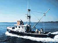
| Platform |
|
||||||||
| Itinerary |
|
||||||||
| Bounds |
|
| Organization |
384 Woods Hole Road
Quissett Campus
Woods Hole, MA02543-1598
(508) 548-8700
|
||
|---|---|---|---|
| Principal investigators | Lawrence J Poppe | ||
| Crew members |
|
||
| Affiliate principal | Ralph Lewis, CGS | ||
| Affiliate staff | Connecticut Geologic Survey (CGS) - Ralph Lewis, Sid Quarrier; Univ. New Haven - Roman Zajac, Jana Newman, 2 students; Indiana Univ. - Boc Wintsch, 3 students; Doug Tolderlund - Coast Guard Academy; Ari Locklear - Southern Connecticut College |
| Data category: | Imagery, Location-Elevation, Sampling |
|---|---|
| Data type: | Photo, Video, Navigation, Geology |
| Name | Survey Equipment | Description |
|---|---|---|
| Cruise report | (document not focused on specific equipment) | Chief Scientist's cruise report including personnel, purpose, equipment, tabulated information, table of sample locations, and map of study area. |
| Sample log | Van Veen grab sampler | Watchstanders' sample log containing identifier, time, position, sampler, and visual description of sample. |
| Equipment | Usage description | Data types | Datasets |
|---|---|---|---|
| Van Veen grab sampler | Geology | 2 | |
| DGPS | Navigation | (no data reported) | |
| Megapulse Accufix 500 LORAN-C | Navigation | (no data reported) | |
| Osprey camera system | Photo, Video | (no data reported) |
| Dataset name | Equipment | Description | Dataset contact |
|---|---|---|---|
| 1992-009-FA-SC-001 | Van Veen grab sampler | GRAB samples | Brian Buczkowski |
| Dataset name | Equipment | Description | Dataset contact |
|---|---|---|---|
| listex | Van Veen grab sampler | Distribution of surficial sediments in Long Island Sound created by a computer model. Dataset includes polygons representing land. | Lawrence J Poppe |