| Identifier | 2001-010-FA | ||||||||
|---|---|---|---|---|---|---|---|---|---|
| Alternate names | IB S-1-01-GM | ||||||||
| Purpose | Use sidescan sonar, multibeam bathymetry, and high-resolution seismic data to map the geologic framework and distribution of deep water reefs west of the Florida Keys. An ROV was used to video the deep-water reef to determine extent and composition of benthic biota. | ||||||||
| Location | Pulley Ridge, southeastern Gulf of America (Gulf of Mexico), Florida, United States, North America, North Atlantic; | ||||||||
| Summary | Cruise ended early due to World Trade Center terrorism and tropical depression forming in the study area. | ||||||||
| Comments | Original Center People field contained: Chuck Worley - technician to maintain sidescan and navigation gear; Erika Hammar-Klose - processor for sidescan mapping; Ken Parolski - cruise mobilization. Project = Deep-water reefs, Deep-water reefs | ||||||||
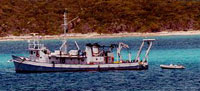
| Platform |
|
||||||||
| Itinerary |
|
||||||||
| Bounds |
|
| Organization |
384 Woods Hole Road
Quissett Campus
Woods Hole, MA02543-1598
(508) 548-8700
|
||||||
|---|---|---|---|---|---|---|---|
| Principal investigators | David C Twichell | ||||||
| Crew members |
|
||||||
| Information specialist(s) |
|
||||||
| Affiliate principal | Robert Halley, USGS-St. Pete; Al Hine, USF | ||||||
| Affiliate staff | Bob Halley, USGS-St. Pete - co-chief scientist; Katie Ciembronowicz, USGS-St. Pete - watchstander; Al Hine, Univ. South Florida - co-chief scientist; Stan Locker, Univ. South Florida - seismic data acquisition and processing; David Naar, Univ. South Florida - multibeam data acquisition and processing; Bret Jarrett, Univ. South Florida - watchstander; Glen Taylor, NOAA-NURP - ROV operator |
| Data category: | Imagery, Location-Elevation, Seismics, Sonar |
|---|---|
| Data type: | Photo, Video, Navigation, Boomer, Multibeam, Sidescan |
| Name | Survey Equipment | Description |
|---|---|---|
| Navigation log | DGPS | Technicians' navigation log book of time, line and file changes, equipment and data acquisition notes. |
| ISIS log | Edgetech DF-1000 sidescan sonar | Technicians' ISIS system logbook of time, line and file changes and equipment settings. |
| Equipment | Usage description | Data types | Datasets |
|---|---|---|---|
| Boomer | Boomer | (no data reported) | |
| Video camera - deep sea | Video | (no data reported) | |
| DGPS | Navigation | 1 | |
| Edgetech DF-1000 sidescan sonar | Sidescan | 2 | |
| ISIS | Sidescan | (no data reported) | |
| Simrad EM 3000 | Multibeam | 1 | |
| HYPACK | Navigation | (no data reported) | |
| Digital camera | Photo | 1 | |
| Single channel hydrophone | Air Gun / Water Gun, Boomer, Bubble Gun, Sparker, Sub Bottom Profiler | 2 |
| Dataset name | Equipment | Description | Dataset contact |
|---|---|---|---|
| 2001-010-FA-LN-001 | DGPS | Processed navigation data | Nancy K. Soderberg |
| 2001-010-FA-SO-001 | Edgetech DF-1000 sidescan sonar | DVD ROM disk of L1-42, PULLEY RIDGE, | Nancy K. Soderberg |
| Sidescan mosaic | Edgetech DF-1000 sidescan sonar | Linda P McCarthy | |
| Bathymetry GIS data | Simrad EM 3000 | Linda P McCarthy | |
| 2001-010-FA-PH-001 | Digital camera | Deck photos of field activity operations | Charles R Worley |
| 2001-010-FA-SE-001 | Single channel hydrophone | Raw SEGY data | Nancy K. Soderberg |
| Boomer seismic data | Single channel hydrophone | Linda P McCarthy |