| Identifier | 2022-014-FA | ||||||||
|---|---|---|---|---|---|---|---|---|---|
| Alternate names | Marconi Beach 2022 | ||||||||
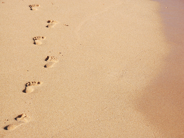
| Purpose | To characterize the beach and nearshore morphology to validate the USGS Total Water Level and Coastal Change Forecast that uses the ARGUS Camera systems (CoastCams) to visualize and map the beach and nearshore region to determine the types of bar morphologies, their persistence and temporal variability, and the relationship of these changes to wave and water-level conditions. This subaerial survey measurements to map the beach; aerial imagery from kite/balloon to map the beach; and bathymetric soundings from WHOI autonomous surface vehicle to map nearshore. | ||||||||
| Location | Marconi Beach, Wellfleet, Cape Cod National Seashore, Barnstable County, MA, United States | ||||||||
| Summary | Field Surveys took two days. Helikite survey was completed at low tide with a mix of Aeropoints and tarp targets as ground control. RTK GPS measurements and Propeller network were within 2 cm. PPK GPS data on camera was post processed. Bathymetry was collected a week after the helikite survey - ASV Yellowfin with a single beam echosounder was successful. No issues. | ||||||||
| Info derived | Yearly update on topography and bathymetry of the beach and nearshore region in view of the cameras. | ||||||||
| Comments | 2022-03-12: Used helikite, SP80, and aeropoints to collect topography data and imagery (J. Over, M. Bartlett, C. Sherwood, P. Traykovski) 2022-03-16: Bathymetry with Yellowfin and single-beam echosounder (J. Over, C. Sherwood, and P. Traykovski) Entries for this field activity are based on entries from Field Activity 2021-014-FA for the Head of the Meadow Field Work and from Field Activity 2021-022-FA. | ||||||||
| Projects | |||||||||
| Platform |
|
||||||||
| Itinerary |
|
||||||||
| Bounds |
|
| Organization |
384 Woods Hole Road
Quissett Campus
Woods Hole, MA02543-1598
(508) 548-8700
|
||||||
|---|---|---|---|---|---|---|---|
| Principal investigators | Christopher R Sherwood | ||||||
| Crew members |
|
||||||
| Information specialist(s) |
|
||||||
| Affiliate principal | Peter Traykovski (WHOI) |
| Data category: | Imagery, Location-Elevation, Sonar |
|---|---|
| Data type: | Photo, Navigation, Single Beam |
| Equipment | Usage description | Data types | Datasets |
|---|---|---|---|
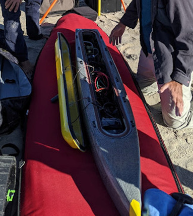
| Cerulean Sonar S-500 Sounder | placed in ASV to record depth to seafloor | Single Beam | 3 |
| PPK GPS | Hot shoed to the camera so there is highly accurate photo location information | Navigation | (no data reported) |
| Aeropoint targets | Placed in survey area as ground control for structure from motion | Navigation, Transects, Profiles | 1 |
| Digital camera | JPEG taken every 5 seconds. | Photo | 3 |
| UAS- heli-kite | Filled with helium and towed by hand up and down the beach with a digital camera and ppk GPS attached. | Photo, Navigation, Video | (no data reported) |
| Spectra Precision SP80 | used in RTK mode to provide location information to the tarp targets used as ground control | Navigation | 1 |
| Dataset name | Equipment | Description | Dataset contact |
|---|---|---|---|
| 2022014FA_Marconi_Bathymetry_1m_cog | Cerulean Sonar S-500 Sounder | Bathymetric data and grid of offshore Marconi Beach, Wellfleet, on March 16, 2022 | Jin-Si R Over |
| 2022014FA_Marconi_raw_bathymetry | Cerulean Sonar S-500 Sounder | Depth soundings along tracklines and GPS locations. | Jin-Si R Over |
| 2022014FA_Marconi_Topobathy_1m_cog | Cerulean Sonar S-500 Sounder | Topobathy grid representing the backshore to the nearshore at Marconi Beach, Wellfleet from data collected on March 11 and 16, 2022 | Jin-Si R Over |
| Aeropoints Marconi Beach | Aeropoint targets | XYZ of ground control point - combined with GPS RTK information on Tarp Targets. Data published combined with SP80 data into 2022014FA_Marconi_nav_GCPs.csv | Jin-Si R Over |
| 2022014FA_Marconi_DSM_25cm_cog | Digital camera | Digital surface model representing Marconi Beach, Wellfleet on March 11, 2022. Created with structure-from-motion using images and GCPs. | Jin-Si R Over |
| 2022014FA_Marconi_Orthomosaic_10cm_cog | Digital camera | Orthomosaic representing Marconi Beach, Wellfleet on March 11, 2022. Created with structure-from-motion using images and GCPs | Jin-Si R Over |
| Aerial photos of Marconi Beach | Digital camera | JPEG images taken with a SONY a6000 with 20mm f2.8 lens. Pictures taken every 5 seconds. Camera was attached to Helikite at Marconi Beach, Wellfleet on March 11, 2022. Picture locations and EXIF information are included in images and as a CSV | Jin-Si R Over |
| Ground Control Points - Tarps | Spectra Precision SP80 | XYZ of ground control points - combined with Aeropoint information into 2022014FA_Marconi_nav_GCPs.csv. | Jin-Si R Over |