| Identifier | 2023-001-FA | ||||||||
|---|---|---|---|---|---|---|---|---|---|
| Purpose | Map and define the geologic framework of Nantucket Sound. | ||||||||
| Location | Nantucket Sound, MA | ||||||||
| Summary | Approximately 19 sq km of Teledyne T20P multibeam sonar data was collected along 424 km of lines spaced 52 and 40 meters apart during 8 days of survey operations. EdgeTech 3400 seismic profiles were collected along 394 kms of tracklines. In addition, sediment samples, bottom video, and photographs were collected at 60 locations using the mini-SEABOSS Sampler. Ground validation locations covered both 2023-001-FA and 2022-001-FA acoustic data. | ||||||||
| Info derived | geologic framework | ||||||||
| Comments | Ackerman is POC for ALL SEABOSS related items. Updated this FAN on 4/9/2026) to move up the start date to 05-12-2023 to account for the SEABOSS test survey, which ended up being usable data and will be included in the data release. (SDA) | ||||||||
| Projects | |||||||||
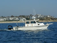
| Platform |
|
||||||||
| Itinerary |
|
||||||||
| Bounds |
|
| Organization |
384 Woods Hole Road
Quissett Campus
Woods Hole, MA02543-1598
(508) 548-8700
|
||||||||||||||||
|---|---|---|---|---|---|---|---|---|---|---|---|---|---|---|---|---|---|
| Principal investigators | Laura Brothers | ||||||||||||||||
| Crew members |
|
||||||||||||||||
| Information specialist(s) |
|
| Data category: | Sonar, Seismics, Sampling, Location-Elevation, Imagery |
|---|---|
| Data type: | Sound Velocity, Multibeam, Sub Bottom Profiler, Geology, Navigation, Video, Photo |
| Equipment | Usage description | Data types | Datasets |
|---|---|---|---|
| AML Minos X | Sound Velocity | 1 | |
| Blackfly S 5MP camera | Photo | 1 | |
| DSPL HD Mulit Seacam | Video | 2 | |
| AML-3 LGR | Sound Velocity | 1 | |
| Reson T20-P | Multibeam, Water column reflectivity | 3 | |
| Edgetech 3400 | Sub Bottom Profiler | 1 | |
| SeaBOSS | Surveys (biological), Experiments (biological), Species ID, Photo, Video, Geology, Biology | 1 | |
| POS-MV | Navigation | (no data reported) |
| Dataset name | Equipment | Description | Dataset contact |
|---|---|---|---|
| 2023-001-FA_videos | DSPL HD Mulit Seacam | Locations and Geotagged sea-floor videos collected in May and June 2023 using the SEABOSS 2.0 in Nantucket Sound, Massachusetts, in the vicinity of Horseshoe Shoal, by the U.S. Geological Survey during field activity 2023-001-FA (MP4 video files and polyline shapefile, GCS WGS 84) | Seth Ackerman |
| 2023-001-FA_TeledyneSeaBat_T20P_Backscatter_1m | Reson T20-P | Multibeam backscatter data collected in Nantucket Sound Massachusetts in the vicinity of Horseshoe Shoal, during USGS Field Activity 2023-001-FA using a Teledyne Reson SeaBat Integrated Dual-Head (IDH) T20-P multibeam echosounder (8-bit GeoTIFF, UTM Zone 19N, NAD 83 (2011), 1-m resolution) | Brian Andrews |
| 2023-001-FA_TeledyneSeaBat_T20P_Bathymetry_2m | Reson T20-P | Multibeam bathymetric data collected in Nantucket Sound Massachusetts in the vicinity of Horseshoe Shoal, during USGS Field Activity 2023-001-FA using a Teledyne Reson SeaBat Integrated Dual-Head (IDH) T20-P multibeam echosounder (32-bit GeoTIFF, UTM Zone 19N, NAD 83 (2011), MLLW Datum, 2-m resolution, and Generic Sensor Format.) | Brian Andrews |
| 2023-001-FA_TeledyneSeaBat_T20P_Tracklines | Reson T20-P | Trackline navigation data collected in Nantucket Sound Massachusetts in the vicinity of Horseshoe Shoal, during USGS Field Activity 2023-001-FA using a Teledyne Resonb SeaBat Integrated Dual-Head (IDH) T20-P multibeam echosounder (Esri polyline shapefile, Geographic, WGS 84) | Brian Andrews |
| 2023-001-FA_ET3400 | Edgetech 3400 | Chirp seismic reflection data- shotpoints, tracklines, profile images, and SEG-Y traces for EdgeTech 3400 chirp data collected in Nantucket Sound Massachusetts in the vicinity of Horseshoe Shoal during USGS field activity 2023-001-FA (point and polyline shapefiles, CSV text, PNG Images, and SEGY data, GCS WGS 84). The largest dataset at almost 8 GB are the SEG-Y files. | Wayne E Baldwin |
| 2023-001-FA_samples | SeaBOSS | Locations and grain-size analysis results of sediment samples collected in May and June 2023 using the SEABOSS 2.0 in Nantucket Sound, Massachusetts, in the vicinity of Horseshoe Shoal, by the U.S. Geological Survey during field activity 2023-001-FA (point shapefile and CSV file, GCS WGS 84) | Seth Ackerman |
| Dataset name | Equipment | Description | Dataset contact |
|---|---|---|---|
| 2023-001-FA_SVP_data | AML Minos X | Sound Velocity Profiles collected in Nantucket Sound Massachusetts in the vicinity of Horseshoe Shoal, during USGS Field Activity 2023-001-FA using AML-3 LGR or AML Minos-X CTDSV sensors (PNG images, SVP text, and ESRI point shapefile, GCS WGS 84) | Brian Andrews |
| 2023-001-FA_images | Blackfly S 5MP camera | Locations and Geotagged sea-floor images collected in May and June 2023 using the SEABOSS 2.0 in Nantucket Sound, Massachusetts, in the vicinity of Horseshoe Shoal, by the U.S. Geological Survey during field activity 2023-001-FA (JPEG images, point shapefile, and CSV file; GCS WGS 84) | Seth Ackerman |
| 2023-001-FA_images | DSPL HD Mulit Seacam | Locations and Geotagged sea-floor images collected in May and June 2023 using the SEABOSS 2.0 in Nantucket Sound, Massachusetts, in the vicinity of Horseshoe Shoal, by the U.S. Geological Survey during field activity 2023-001-FA (JPEG images, point shapefile, and CSV file; GCS WGS 84) | Seth Ackerman |
| 2023-001-FA_SVP_data | AML-3 LGR | Sound Velocity Profiles collected in Nantucket Sound Massachusetts in the vicinity of Horseshoe Shoal, during USGS Field Activity 2023-001-FA using AML-3 LGR or AML Minos-X CTDSV sensors (PNG images, SVP text, and ESRI point shapefile, GCS WGS 84) | Brian Andrews |
123 images are associated with this activity.