| Benthic habitats of the coral reef ecosystem off the coast of Pu'ukohola Heiau (PUHE) National Historic Site |
underwatertelevision |
A benthic habitat polygon coverage has been created of the coral reef ecosystem off the coast of Pu'ukohola Heiau (PUHE) National Historic Site on the Kona Coast of Hawai'i. Polygons were hand-digitized from visual interpretation of aerial photography and SHOALS bathymetry data. We also utilized in situ knowledge from towed instruments, underwater photography and videography, and diver and snorkeler observations. The polygons have attributes for Main Structure/Substrate, Dominant Structure/Substrate, Major Biological Cover, Percent of Major Biological Cover, Reef Zone, and Unique ID, and measurements of area (m2) of each polygon. |
Susan Cochran |
| Benthic habitats of the coral reef ecosystem off the coast of Kaloko-Honokohau (KAHO) National Historical Park |
underwatertelevision |
A benthic habitat polygon coverage has been created of the coral reef ecosystem within and adjacent to Kaloko-Honokohau (KAHO) National Historical Park on the Kona Coast of Hawai'i. Polygons were hand-digitized from visual interpretation of aerial photography and SHOALS bathymetry data. We also utilized in situ knowledge from towed instruments, underwater photography and videography, and diver and snorkeler observations. The polygons have attributes for Main Structure/Substrate, Dominant Structure/Substrate, Major Biological Cover, Percent of Major Biological Cover, Reef Zone, Unique ID, and measurements of Area (m2) of each polygon. |
Ann E Gibbs |
| Benthic habitats of the coral reef ecosystem off the coast of Pu'uhonua O Honaunau (PUHO) National Historical Park |
underwatertelevision |
A benthic habitat polygon coverage has been created of the coral reef ecosystem off the coast of Pu'uhonua O Honaunau (PUHO) National Historical Park on the Kona Coast of Hawai'i. Polygons were hand-digitized from visual interpretation of aerial photography and SHOALS bathymetry data. We also utilized in situ knowledge from towed instruments, underwater photography and videography, and diver and snorkeler observations. The polygons have attributes for Main Structure/Substrate, Dominant Structure/Substrate, Major Biological Cover, Percent of Major Biological Cover, Reef Zone, Unique ID, and measurements of area (m2) of each polygon. |
Susan Cochran |
| Underwater imagery of the substrate and coral reef habitat on the Kona coast of the Island of Hawaiʻi, from 2003, 2004, and 2022 |
underwatertelevision |
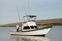
Images of the seafloor off the Kona coast of the Island of Hawaiʻi were collected by the United States Geological Survey in 2003, 2004, and 2022, during field activities A803HW, A204HW, A604HW, and 2022-615-FA. The images were collected in cooperation with the National Park Service, primarily in the waters off Kaloko-Honokōhau National Historical Park, Puʻukoholā Heiau National Historic Site, and Puʻuhonua o Hōnaunau National Historical Park. The 2003 and 2004 images were acquired using a SeaViewer underwater video camera, either towed behind a research vessel or lowered over the side while drifting. GPS positions from a boat-mounted receiver were encoded into the video. Still frames were extracted from the video and geotagged by writing the geographic positions into each image’s EXIF metadata. The 2022 images were acquired using a Teledyne FLIR camera in an underwater housing. The camera was lowered over the side of the vessel and set to capture one image every two seconds while drifting. GPS positions were recorded using a boat-mounted, differentially processed GPS receiver. The images were geotagged by writing the geographic positions into each image’s EXIF metadata. The time stamps for all images in this data release are in Coordinated Universal Time (UTC). The images provided in this data release were used to evaluate coral cover and were manually classified by a specialist. Only the images used in this project are included in the release. |
Logan Grady |
| Classifications of underwater imagery of the substrate and coral reef habitat on the Kona coast of the Island of Hawaiʻi, from 2003, 2004, and 2022 |
underwatertelevision |
This portion of the data release presents a comma-delimited text file with classifications of images of the seafloor off the Kona coast of the Island of Hawaiʻi. The images were collected by the United States Geological Survey in 2003, 2004, and 2022, during field activities A803HW, A204HW, A604HW, and 2022-615-FA, in cooperation with the National Park Service, primarily in the waters off Kaloko-Honokōhau National Historical Park, Puʻukoholā Heiau National Historic Site, and Puʻuhonua o Hōnaunau National Historical Park. The images were classified for live coral cover and dominant type (four coral types, rubble, macroalgae, and two bottom substrate types) manually by a single specialist with a background in ecological studies. The resulting classifications were tabulated in a comma-delimited text file for further analysis. |
Logan Grady |
| Benthic habitats of the coral reef ecosystem off the coast of Pu'ukohola Heiau (PUHE) National Historic Site |
underwatercamera |
A benthic habitat polygon coverage has been created of the coral reef ecosystem off the coast of Pu'ukohola Heiau (PUHE) National Historic Site on the Kona Coast of Hawai'i. Polygons were hand-digitized from visual interpretation of aerial photography and SHOALS bathymetry data. We also utilized in situ knowledge from towed instruments, underwater photography and videography, and diver and snorkeler observations. The polygons have attributes for Main Structure/Substrate, Dominant Structure/Substrate, Major Biological Cover, Percent of Major Biological Cover, Reef Zone, and Unique ID, and measurements of area (m2) of each polygon. |
Susan Cochran |
| Benthic habitats of the coral reef ecosystem off the coast of Kaloko-Honokohau (KAHO) National Historical Park |
underwatercamera |
A benthic habitat polygon coverage has been created of the coral reef ecosystem within and adjacent to Kaloko-Honokohau (KAHO) National Historical Park on the Kona Coast of Hawai'i. Polygons were hand-digitized from visual interpretation of aerial photography and SHOALS bathymetry data. We also utilized in situ knowledge from towed instruments, underwater photography and videography, and diver and snorkeler observations. The polygons have attributes for Main Structure/Substrate, Dominant Structure/Substrate, Major Biological Cover, Percent of Major Biological Cover, Reef Zone, Unique ID, and measurements of Area (m2) of each polygon. |
Ann E Gibbs |
| Benthic habitats of the coral reef ecosystem off the coast of Pu'uhonua O Honaunau (PUHO) National Historical Park |
underwatercamera |
A benthic habitat polygon coverage has been created of the coral reef ecosystem off the coast of Pu'uhonua O Honaunau (PUHO) National Historical Park on the Kona Coast of Hawai'i. Polygons were hand-digitized from visual interpretation of aerial photography and SHOALS bathymetry data. We also utilized in situ knowledge from towed instruments, underwater photography and videography, and diver and snorkeler observations. The polygons have attributes for Main Structure/Substrate, Dominant Structure/Substrate, Major Biological Cover, Percent of Major Biological Cover, Reef Zone, Unique ID, and measurements of area (m2) of each polygon. |
Susan Cochran |
| Underwater imagery of the substrate and coral reef habitat on the Kona coast of the Island of Hawaiʻi, from 2003, 2004, and 2022 |
underwatercamera |
Images of the seafloor off the Kona coast of the Island of Hawaiʻi were collected by the United States Geological Survey in 2003, 2004, and 2022, during field activities A803HW, A204HW, A604HW, and 2022-615-FA. The images were collected in cooperation with the National Park Service, primarily in the waters off Kaloko-Honokōhau National Historical Park, Puʻukoholā Heiau National Historic Site, and Puʻuhonua o Hōnaunau National Historical Park. The 2003 and 2004 images were acquired using a SeaViewer underwater video camera, either towed behind a research vessel or lowered over the side while drifting. GPS positions from a boat-mounted receiver were encoded into the video. Still frames were extracted from the video and geotagged by writing the geographic positions into each image’s EXIF metadata. The 2022 images were acquired using a Teledyne FLIR camera in an underwater housing. The camera was lowered over the side of the vessel and set to capture one image every two seconds while drifting. GPS positions were recorded using a boat-mounted, differentially processed GPS receiver. The images were geotagged by writing the geographic positions into each image’s EXIF metadata. The time stamps for all images in this data release are in Coordinated Universal Time (UTC). The images provided in this data release were used to evaluate coral cover and were manually classified by a specialist. Only the images used in this project are included in the release. |
Logan Grady |
| Classifications of underwater imagery of the substrate and coral reef habitat on the Kona coast of the Island of Hawaiʻi, from 2003, 2004, and 2022 |
underwatercamera |
This portion of the data release presents a comma-delimited text file with classifications of images of the seafloor off the Kona coast of the Island of Hawaiʻi. The images were collected by the United States Geological Survey in 2003, 2004, and 2022, during field activities A803HW, A204HW, A604HW, and 2022-615-FA, in cooperation with the National Park Service, primarily in the waters off Kaloko-Honokōhau National Historical Park, Puʻukoholā Heiau National Historic Site, and Puʻuhonua o Hōnaunau National Historical Park. The images were classified for live coral cover and dominant type (four coral types, rubble, macroalgae, and two bottom substrate types) manually by a single specialist with a background in ecological studies. The resulting classifications were tabulated in a comma-delimited text file for further analysis. |
Logan Grady |