| Identifier |
1990-009-FA |
| Alternate names |
ERDA-90-1, LEG 2 H-90-1 |
| Purpose |
Collect nearshore high-resolution seismics as part of ongoing coastal geologic framework studies in state cooperative projects. |
| Location |
Hancock County, Mississippi, Louisiana, Mississippi Sound, Gulf of America (Gulf of Mexico), United States, North America, North Atlantic; |
| Summary |
6 rolls seismic data; 18 magnetic data tapes for entire cruise (all legs). |
| Comments |
Also see Field Activities 90008 and 90011.
Project = MS-AL-USGS Co-op, MS-AL-USGS Co-op |
| Related activities |
|
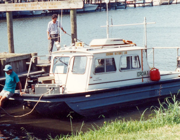
| Platform |
| Erda-1 Length 24 feet.
|
 |
|
| Itinerary |
| Start |
Bayou Caddy Marina, Waveland, MS |
1990-06-13 |
| End |
Bayou Caddy Marina, Waveland, MS |
1990-06-17 |
| Days in the field |
1 |
|
| Bounds |
| West |
-89.67 |
| East |
-89.16 |
| North |
30.3 |
| South |
30.05 |
|