| Identifier |
2006-601-FA |
| Alternate names |
CN106CA, IV106CA, VN106CA |
| Purpose |
Monitor changes in sand distribution and movement in nearshore portions of the Santa Barbara littoral cell between Goleta and Mugu submarine canyon |
| Location |
Santa Barbara, CA |
| Info derived |
Nearshore bathymetry and beach topography |
| Comments |
This activity encompasses FACS ID's CN106CA, IV106CA and VN106CA; entered by CR 1/6/2015 |
| Projects |
|
| Platform |
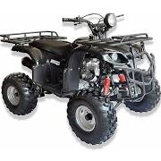
| ATV |
 |
|
| Vehicles |
|
| Itinerary |
| Start |
unknown |
2006-03-25 |
| End |
unknown |
2006-03-25 |
|
| Bounds |
| West |
-120.196 |
| East |
-119.06358175 |
| North |
34.61208894 |
| South |
34.07921889 |
|