| Identifier |
2021-006-FA
-- CANCELED
|
| Purpose |
To collect reconnaissance bathymetric data and assess the viability of future big-boat geological mapping studies. Equipment or personnel only. Data, if any, are managed under a different field activity.
|
| Location |
South west off of Nantucket |
| Info derived |
bathymetry |
| Projects |
|
| Platform |
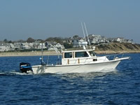
| Rafael 25 feet
|
 |
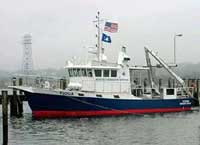
| Tioga Length: 60 feet; Beam: 17 feet.
|
 |
|
| Itinerary |
| Start |
Woods Hole |
2021-07-12 |
| End |
Nantucket, MA |
2021-07-26 |
| Days in the field |
2 |
|
| Bounds |
| West |
-70.79589844 |
| East |
-69.08203125 |
| North |
41.67291182 |
| South |
40.79717742 |
|