| Identifier |
2022-007-FA |
| Alternate names |
Martens cruise |
| Purpose |
USGS purpose: Collect EK80 data to support NSF-funded seep-based project for Prof Chris Martens at UNC |
| Location |
Upper continental slope Delaware to Hatteras |
| Summary |
Collect continuous EK80 data to identify active methane seepage during deployments of Martens' landers |
| Info derived |
EK80 imagery |
| Comments |
EK80 with 38 kHz transducer and custom Sharp tranducer mount |
| Projects |
|
| Platform |
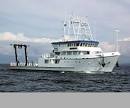
| Hugh R. Sharp Length 146 feet/ beam 32 feet.
|
 |
|
| Itinerary |
| Start |
Lewes, DE |
2022-07-31 |
| End |
Lewes, DE |
2022-08-11 |
| Days in the field |
10 |
|
| Bounds |
| West |
-75.41015625 |
| East |
-72.59765625 |
| North |
39.50404071 |
| South |
34.34343607 |
|