| Identifier |
2024-028-FA |
| Alternate names |
CACO Waves |
| Purpose |
To deploy a nanopod within view but offshore of the Marconi Camera site. Data collected will help validate the total water level model. |
| Location |
Marconi Beach, MA |
| Info derived |
waves, currents, grain size, water levels, conductivity, temperature |
| Comments |
Deployment delayed from original schedule (12/3-4) due to ship scheduling backlog due to bad weather in November. |
| Projects |
|
| Platform |
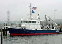
| Tioga Length: 60 feet; Beam: 17 feet.
|
 |
|
| Itinerary |
| Start |
Woods Hole MA USA |
2024-12-06 |
| End |
Woods Hole, MA |
2024-12-13 |
| Days in the field |
1 |
|
| Bounds |
| West |
-70.00350952 |
| East |
-69.88128662 |
| North |
41.96255364 |
| South |
41.82454868 |
|