| Identifier | J295MB | ||||||||
|---|---|---|---|---|---|---|---|---|---|
| Alternate names | J-2-95-MB | ||||||||
| Description | Chief Scientists: Roberto Anima, Andy Stevenson, Steve Eittreim. Geophysical data (sidescansonar, navigation, bathymetry) of field activity J-2-95-MB in Monterey Bay from 03/06/1995 to 04/15/1995 | ||||||||
| Location | Monterey Bay | ||||||||
| Comments | physical data holdnings Associated activities: M-1-93-MB J-1-94-MB J-2-95-MB J-6-95-MB M-2-95-MB P-1-95-MB P-3-95-MB R-1-95-MB M-1-96-MB J-1-97-MB J-3-97-MB A-4-98-MB J-3-98-MB J-4-98-MB MBMS NEARSHORE STUDIES: In spite of rough seas and nasty weather the David Johnston completed 19 out of a scheduled 40 days of high-resolution seismic reflection and side-scan surveys along the nearshore coastal area in the Monterey Bay Marine Sanctuary between Aptos and Ano Nuevo. Roberto Anima, Andy Stevenson, Steve Eittreim, and Jim Tait (UCSC) report that they, with support from ETs Mike Boyle and Fred Payne, were able to collect excellent records that imaged the extent of submarine outcrops and subbottom features. Correlations with coastal bluff exposures were apparent. The surveys are part of a continuing program to compile a side-scan sonar mosaic of the offshore area of Monterey Bay Marine Santuary. Graduate and undergraduate students from U.C. Santa Cruz joined the cruise to observe the data collection processes. R. Anima Staff information imported from InfoBank Roberto Anima (USGS Western Region) - Chief Scientist Andy Stevenson (USGS Western Region) - Chief Scientist Steve Eittreim (USGS Western Region) - Chief Scientist | ||||||||
| Projects | |||||||||
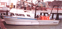
| Platform |
|
||||||||
| Itinerary |
|
||||||||
| Bounds |
|
||||||||
| Activity | Geophysical |
| Principal investigators | Anima, RobertoStevenson, AndyEittreim, Steve |
|---|---|
| Crew members |
| Data category: | Location-Elevation, Seismics, Sonar |
|---|---|
| Data type: | Navigation, Boomer, Sidescan, Single Beam |
| Equipment | Usage description | Data types | Datasets |
|---|---|---|---|
| sidescansonar | Sidescan | 2 | |
| navigation | Navigation | 4 | |
| bathymetry | Single Beam | 4 | |
| Geopulse | Boomer | 3 |
| Dataset name | Equipment | Description | Dataset contact |
|---|---|---|---|
| File list | sidescansonar | Roberto Anima | |
| sidescan | sidescansonar | data on FAD | Carol A Reiss |
| Best file with nav in ArcInfo E00 format | navigation | Roberto Anima | |
| Global positioning system (GPS) data j-2-95-mb.060 | navigation | Provisional best file | Roberto Anima |
| Global positioning system (GPS) data j-2-95-mb.060-_130_utm | navigation | Roberto Anima | |
| Global positioning system (GPS) data j-2-95-mb.060_degree | navigation | Roberto Anima | |
| NGDC MGD77 data - bathy | bathymetry | Carolyn Hayashida Degnan | |
| Raw depth (bathymetry) data j-2-95-mb.300 | bathymetry | Roberto Anima | |
| Raw depth (bathymetry) data j-2-95-mb.301 | bathymetry | Roberto Anima | |
| Raw depth (bathymetry) data j-2-95-mb.301_060 | bathymetry | Provisional best file | Roberto Anima |
| seismic | Geopulse | data on FAD | Carol A Reiss |
| Seismic FFID/Shot/CDP data j-2-95-mb.410 | Geopulse | Roberto Anima | |
| Seismic FFID/Shot/CDP data j-2-95-mb.410_geopulse | Geopulse | Provisional best file | Roberto Anima |
Eittreim, S.L.; and Noble, M., 2002, Seafloor geology and natural environment of the Monterey Bay National Marine Sanctuary: Marine Geology 181:1-3, 1, https://doi.org/10.1016/S0025-3227(01)00258-4.
Schreppel, H.A., Degnan, C.H, Dadisman, S.V., and Metzger, D.R., 2013, Archive of U.S. Geological Survey Selected Single-Beam Bathymetry Datasets, 19692000: , http://pubs.usgs.gov/ds/757/.
Schreppel, H.A.; Degnan, C.H.; Dadisman, S.V.; Metzger, D.R., 2013, Archive of U.S. Geological Survey selected single-beam bathymetry datasets, 1969-2000: , https://doi.org/10.3133/ds757.
Wong, F.; and Eittreim, S., 2001, Continental Shelf GIS for the Monterey Bay National Marine Sanctuary: , http://pubs.usgs.gov/of/2001/0179/.