| Identifier | M102WO | ||||||||
|---|---|---|---|---|---|---|---|---|---|
| Alternate names | M-1-02-WO,M2-02-OC | ||||||||
| Description | United States Geological Survey, Menlo Park, California. Chief Scientist: Guy Cochrane. Sidescan Sonar data (Kleinsidescan, GPS, bathymetry, gyro) of field activity M-1-02-WO in Olympic Coast, Washington from 09/10/2002 to 09/16/2002 | ||||||||
| Location | Washington | ||||||||
| Info derived | Benthic habitat | ||||||||
| Comments | Staff information imported from InfoBank Guy Cochrane (USGS, Menlo Park) - Research Geophysicist Mike Boyle (USGS, Redwood City) - Electrical Technician Fred Payne (USGS, Redwood City) - Electrical Technician Lori Hibbeler (USGS, Menlo Park) - Operational Geologist George Galasso (OCNMS, Olympic Coast National Marine Sanctuary, , Port Angeles) - Mission Coordinator Scott Mills (WDFW, WA Dept. Fish & Wildlife, ) - Seabird Observer Ray Buckley (WDFW) - Fish/Kelp Sampler Larry LeClair (WDFW) - Fish/Kelp Sampler Kendara Palmer (OCNMS volunteer) - Seabird/Mammal Assistant Non USGS data manager = Kristen Lee | ||||||||
| Projects | |||||||||
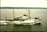
| Platform |
|
||||||||
| Itinerary |
|
||||||||
| Bounds |
|
||||||||
| Activity | Sidescan Sonar |
| Organization |
2885 Mission Street
Santa Cruz, CA95060
(831) 460-7401
|
||||||
|---|---|---|---|---|---|---|---|
| Principal investigators | Guy R Cochrane | ||||||
| Crew members |
|
||||||
| Affiliate staff | Lori Hibbeler (USGS, Menlo Park) - Operational Geologist,George Galasso (OCNMS, Olympic Coast National Marine Sanctuary, , Port Angeles) - Mission Coordinator,Scott Mills (WDFW, WA Dept. Fish & Wildlife, ) - Seabird Observer,Ray Buckley (WDFW) - Fish/Kelp Sampler,Larry LeClair (WDFW) - Fish/Kelp Sampler,Kendara Palmer (OCNMS volunteer) - Seabird/Mammal Assistant |
| Data category: | Location-Elevation, Sonar |
|---|---|
| Data type: | Navigation, Sidescan, Single Beam |
| Equipment | Usage description | Data types | Datasets |
|---|---|---|---|
| Kleinsidescan | Sidescan | 2 | |
| GPS | Navigation | 2 | |
| bathymetry | Single Beam | 1 | |
| gyro | Navigation | 1 |
| Dataset name | Equipment | Description | Dataset contact |
|---|---|---|---|
| File list | Kleinsidescan | Guy R Cochrane | |
| Survey information | Kleinsidescan | Guy R Cochrane | |
| Best file with nav in ArcInfo E00 format | GPS | Guy R Cochrane | |
| Global positioning system (GPS) data m-1-02-wo.060 | GPS | Provisional best file | Guy R Cochrane |
| Survey information | bathymetry | Guy R Cochrane | |
| Survey information | gyro | Guy R Cochrane |