Sediment core data collected from Cargill Marsh, South San Francisco Bay, California during field activities 2022-643-FA and 2023-681-FA
By Joanne C. T Ferreira, Daniel J. Nowacki, and SeanPaul M. La Selle
https://doi.org/10.5066/P15AORBR
Dates
Published: July 11, 2024
Summary
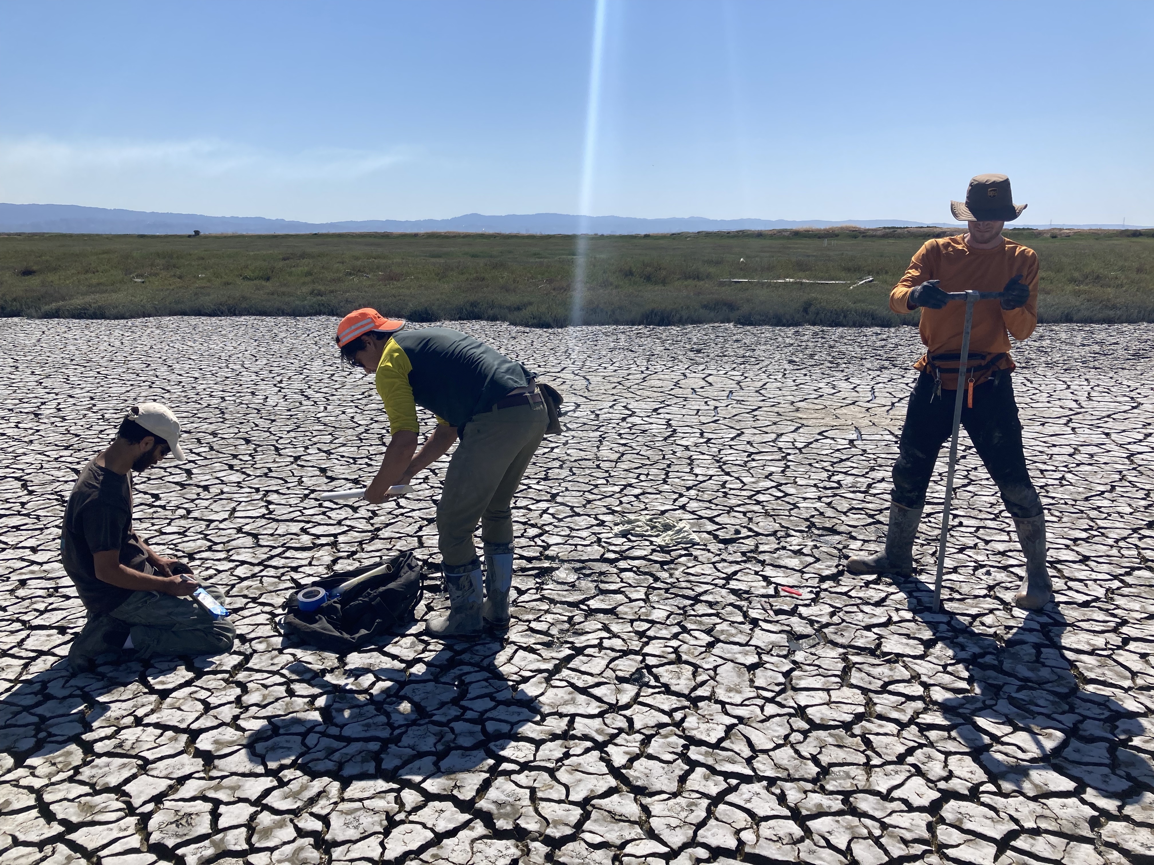
The U.S. Geological Survey Pacific Coastal and Marine Science Center collected cores in the Cargill Marsh section of Whales Tail South Marsh in Eden Landing Ecological Reserve in Alameda County, California in 2022 and 2023. This data release includes photographs, computed tomography (CT) scans, and radiometric data. Details on core locations and measured variables are included in sections for each data type. The data were collected to determine sediment supply and sediment delivery to marshes over decadal time scales. The goal of the project was to more accurately predict the fate of marshes and to optimize management actions. Data were collected as part of a collaborative study with the USGS Western Ecological Research Center. These data are intended for science researchers, students, policy makers, and the general public.
Location-Elevation Data
-
Information on sediment cores collected from Cargill Marsh, South San Francisco Bay, California during field activities 2022-643-FA and 2023-681-FA
This dataset presents core information such as core IDs, core lengths, depth intervals, and locations from sediment cores collected from Cargill Marsh, South San Francisco Bay, California on June 21, 2022, and December 14, 2023. The cores were collected with hand driven push cores to assess sediment accumulation on the marsh.
Data Files
cargill_cores.csv - 798 bytes - MD5:257d913dcb9f7215af9d20d5cd0c910f
Metadata Files
cargill_marsh_cores_metadata.xml - 17.1 KB
cargill_marsh_cores_metadata.txt - 16.5 KB
Imagery Data
-
Computed Tomography (CT) scans of sediment cores collected from Cargill Marsh, South San Francisco Bay, California during field activities 2022-643-FA and 2023-681-FA
This dataset includes computed tomography (CT) scans of sediment cores collected from Cargill Marsh, South San Francisco Bay, California on June 21, 2022, and December 14, 2023. The cores were collected with hand driven push cores to assess sediment accumulation on the marsh. CT images are provided in the original 16-bit grayscale TIFF format.
Data Files
cargill_cores_ct.zip - 48.5 MB - MD5:489b32a32a900c7eb8b2c0d12c5c82c1
Metadata Files
cargill_marsh_ct_metadata.xml - 17.1 KB
cargill_marsh_ct_metadata.txt - 16.5 KB
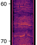 Preview of a CT image from a section of core CAR-RC02, with a false colormap applied to CT intensity values.
 -
Photographs of sediment cores collected from Cargill Marsh, South San Francisco Bay, California during field activities 2022-643-FA and 2023-681-FA
This dataset includes photographs (linescan images) of sediment cores collected from Cargill Marsh, South San Francisco Bay, California on June 21, 2022, and December 14, 2023. The cores were collected with hand driven push cores to assess sediment accumulation on the marsh.
Data Files
cargill_cores_linescan.zip - 503.9 MB - MD5:6cbfacd0733183e54820932e8dd23ba1
Metadata Files
cargill_marsh_linescan_metadata.xml - 17.5 KB
cargill_marsh_linescan_metadata.txt - 17.0 KB
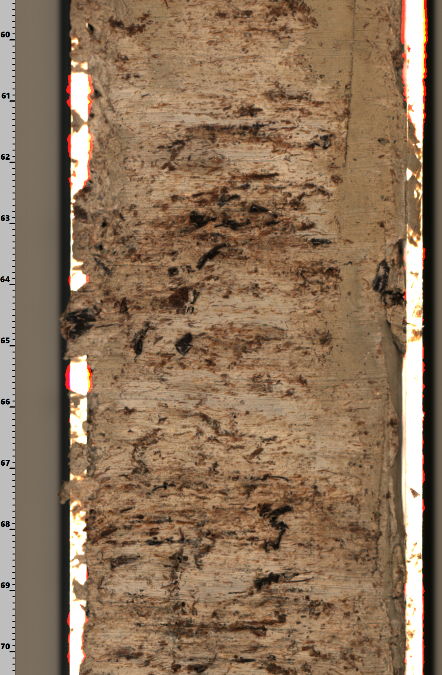
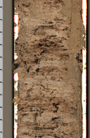 Example linescan image of a section of core CAR-RC02.

Environmental Data
-
Cesium-137 isotope activity measured in sediment cores collected from Cargill Marsh, South San Francisco Bay, California during field activities 2022-643-FA and 2023-681-FA
This dataset presents specific activities of cesium-137 in picoCuries per gram from sediment cores collected from Cargill Marsh, South San Francisco Bay, California on June 21, 2022, and December 14, 2023. The cores were collected with hand driven push cores to assess sediment accumulation on the marsh.
Data Files
2022-643-FA_CAR-RC02_137Cs.csv - 655 bytes - MD5:faccef2a064e8acc1afd5f499eb8e3d7
2023-681-FA_CAR-RC03_137Cs.csv - 460 bytes - MD5:867873fb6dfc91a3aee1495dec749bab
2023-681-FA_CAR-RC04_137Cs.csv - 457 bytes - MD5:7cdd50e4dc3b645a1bd16386e60cc05e
Metadata Files
cargill_marsh_cs137_metadata.xml - 17.1 KB
cargill_marsh_cs137_metadata.txt - 16.6 KB
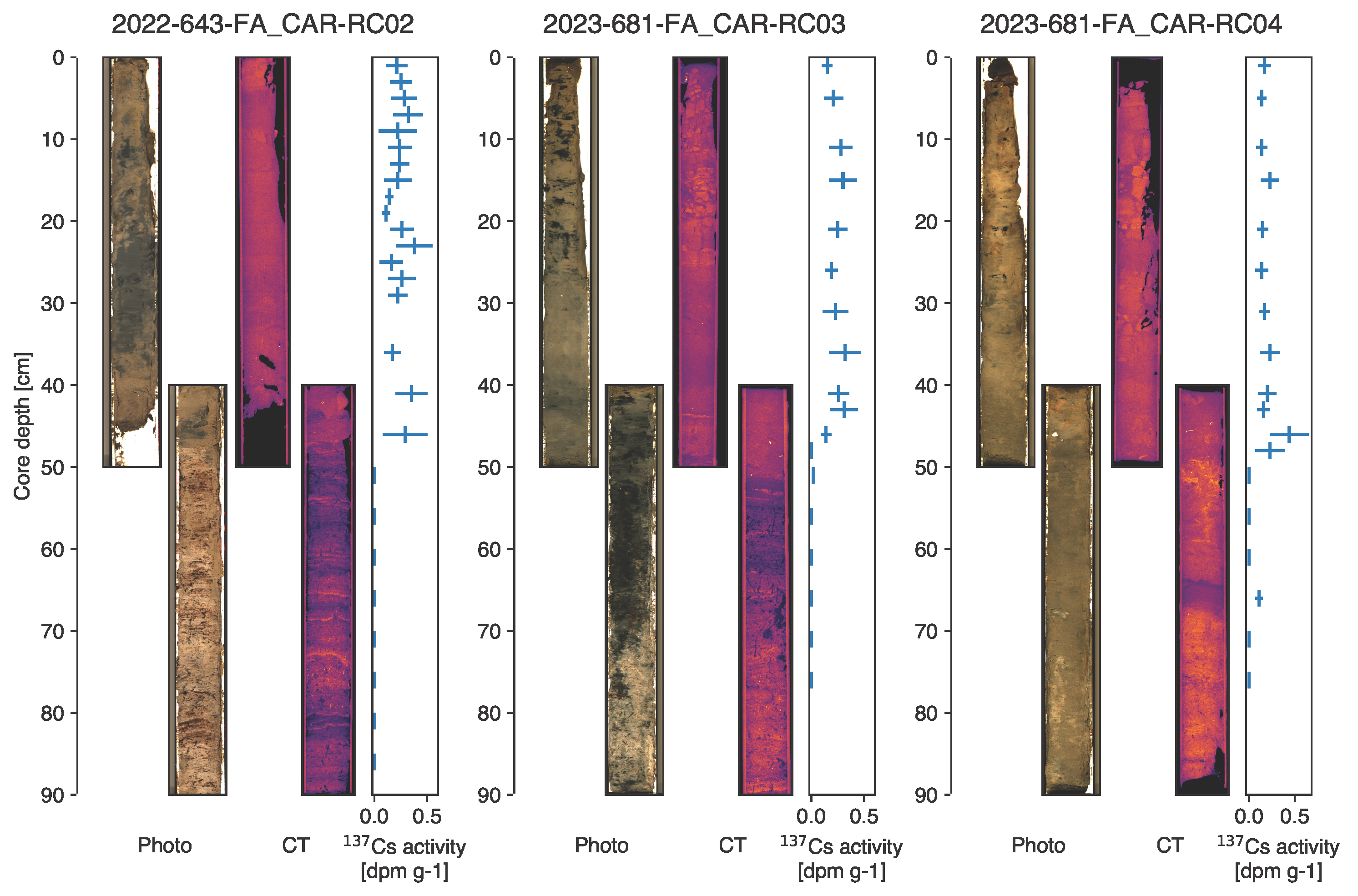
 Side by side comparison of depth referenced linescan images, color-enhanced CT images, and plots of Cesium-137 isotope activity for all cores.
Related Field Activities
- 2022-643-FA - View Details
- 2023-681-FA - View Details
Suggested Citation
Ferreira, J.C.T., Nowacki, D.J., and La Selle, S.M., 2024, Sediment core data collected from Cargill Marsh, South San Francisco Bay, California during field activities 2022-643-FA and 2023-681-FA: U.S. Geological Survey data release, https://doi.org/10.5066/P15AORBR.
Cargill Marsh, South San Francisco Bay, California