| Identifier | 2015-668-FA | ||||||||
|---|---|---|---|---|---|---|---|---|---|
| Purpose | Collect baseline topography and bathymetry for ENSO impacts in Monterey Bay | ||||||||
| Location | Monterey Bay | ||||||||
| Summary | Josh Logan submitted TLS data 10/16/2015 | ||||||||
| Info derived | Beach Topography, Nearshore Bathymetry | ||||||||
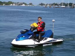
| Comments | During the week of Sept. 28 - Oct. 2 scientists from the U.S. Geological Survey will be working along the coastline from Santa Cruz to Moss Landing. Either by all-terrain vehicle, personal watercraft, or on foot, they will be surveying local beaches and the nearby ocean bottom to compile a three-dimensional map of how beaches change in northern Monterey Bay. Entries for this field activity are based on entries from Field Activity 2014-676-FA Entries for this field activity are based on entries from Field Activity 2015-625-FA | ||||||||
| Projects | |||||||||
| Platform |
|
||||||||
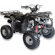
| Vehicles | MarFac; Chevy Suburban - gray; 7 pass; G62-2874L
Jeep Liberty 4X4 - silver
|
||||||||
| Itinerary |
|
||||||||
| Bounds |
|
| Organization |
2885 Mission Street
Santa Cruz, CA95060
(831) 460-7401
|
||
|---|---|---|---|
| Principal investigators | Curt StorlazziJonathan WarrickPatrick Barnard | ||
| Crew members | |||
| Information specialist(s) |
|
| Data category: | Sonar, Location-Elevation |
|---|---|
| Data type: | Single Beam, LIDAR, Navigation, Profiles |
| Equipment | Usage description | Data types | Datasets |
|---|---|---|---|
| Rover - Trimble | Transects, Profiles, Navigation | 1 | |
| Echosounder-1 (Odom Echotrac CV-100) | Single Beam | 1 | |
| Other | Unknown, Profiles, Transects, Benchmarks, LIDAR, Navigation | (no data reported) | |
| LIDAR | LIDAR | 2 |
| Dataset name | Equipment | Description | Dataset contact |
|---|---|---|---|
| Topography data from northern Monterey Bay, California, September and October 2015 | Rover - Trimble | This part of the data release presents topography data from northern Monterey Bay, California collected in September and October 2015. Topography data were collected on foot with survey-grade global navigation satellite system (GNSS) receivers mounted on backpacks and with an all-terrain vehicle (ATV) using a GNSS receiver mounted at a measured height above the ground. | Andrew Stevens |
| Nearshore bathymetry data from northern Monterey Bay, California, September and October 2015 | Echosounder-1 (Odom Echotrac CV-100) | This part of the data release presents bathymetry data from northern Monterey Bay, California collected in September and October 2015 using two personal watercraft (PWCs). The PWCs were equipped with single-beam echosounders and survey-grade global navigation satellite system (GNSS) receivers. | Andrew Stevens |
| Terrestrial lidar data from northern Monterey Bay, California, September 2015 | LIDAR | This part of the data release presents topography data from northern Monterey Bay, California collected in September 2015 with a terrestrial lidar scanner. | Joshua Logan |
| Dataset name | Equipment | Description | Dataset contact |
|---|---|---|---|
| Digital elevation models (DEMs) of northern Monterey Bay, California, September and October 2015 | LIDAR | This part of the data release presents digital elevation models (DEMs) derived from bathymetry and topography data of northern Monterey Bay, California collected in September and October 2015. Bathymetry data were collected using two personal watercraft (PWCs), each equipped with single-beam echosounders and survey-grade global navigation satellite system (GNSS) receivers. Topography data were collected on foot with GNSS receivers mounted on backpacks and with an all-terrain vehicle (ATV) using a GNSS receiver mounted at a measured height above the ground. Additional topography data were collected with a terrestrial lidar scanner. DEM surfaces were produced from all available elevation data using linear interpolation. | Andrew Stevens |